Crop Intensification: Mapping and monitoring of post-kharif rice fallow lands using Satellite Remote Sensing and GIS technologies for Rabi Crop Area Expansion
Under the National Food Security Mission (NFSM), the Department of Agriculture, Cooperation and Farmers’ Welfare has initiated the project Crop Intensification: Mapping and Monitoring of Post-Kharif Rice Fallow Lands using Satellite Remote Sensing and GIS Technologies for Rabi Crop Area Expansion” for two years 2016-17 and 2017-18. The project is being implemented by Mahalanobis National Forecast Centre (MNCFC) in collaboration with National Remote Sensing Centre, Hyderabad.
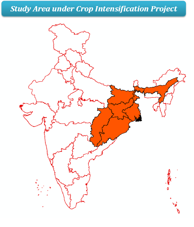
This Programme is being carried out in six study states Assam, Bihar, Chhattisgarh, Jharkhand, Odisha and West Bengal, Which area known for the existence of major post kharif rice fallow lands and their potential for growing rabi crops. Satellite derived thematic layers, spectral indices; weather and soil related data are key data sets in this project.

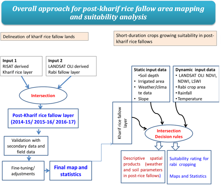
- Delineation of post-kharif rice fallow lands using satellite derived kharif rice area and rabi crop area images for major rice growing states and provide updated information in the form of maps and statistics to the decision makers.
- Characterizing the post-kharif rice fallow lands with edaphic, climatic and other features for crop suitability in rabi season.
- Generation of multi criteria based information product/advisories on crop growing suitability in these post-kharif rice fallow lands
The major objectives of the programme are:


- Generation of District level Kharif rice maps for the Bihar, Chhattisgarh, Jharkhand, Odisha and West Bengal, for the year 2016-17.
- Generation of Chhattisgarh kharif rice, rabi cropped area, post rice fallow and land suitability maps and statistics (2016-17).
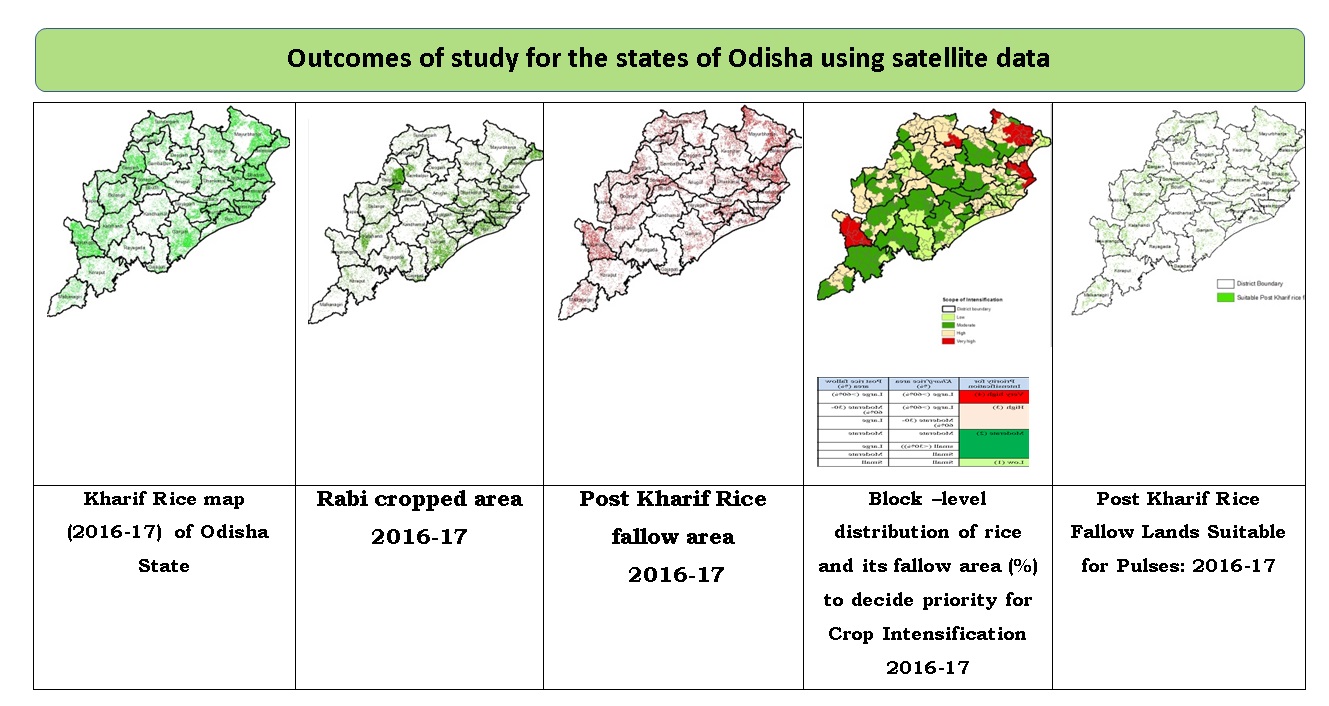
- Generation of Odisha kharif rice, rabi cropped area, post rice fallow and land suitability maps and statistics (2016-17).
- Organized workshop in Odisha & Chhattisgarh states for representation of results & feedback during 2017-18.
- Ground truth data collection for rabi season crops in 5 states (Assam, Bihar, Chhatisgarh, Jharkhand and Odisha) during month of February 2018.


