About CHAMAN
Horticulture sector is a major driver for the growth of of Indian agriculture. Keeping in view the need for reliable and timely horticultural statistics, DAC&FW under the Mission for Integrated Development of Horticulture (MIDH) initiated the project in September 2014, called CHAMAN (Coordinated Horticulture Assessment and Management using geo-informatics) project for better horticulture assessment and development through remote sensing, GIS and field survey.
The Remote Sensing component of the project was implemented by Mahalanobis National Crop Forecast Centre (MNCFC) in collaboration with ISRO/DOS Centres (SAC, NRSC & NESAC), NHRDF, IMD, ICAR, State Horticulture Departments and State Remote Sensing Centres.
Objectives of CHAMAN Phase- I
- Area assessment and production forecasting of 7 major horticultural crops in selected districts of major states (12 states, 185 Districts).
- Geospatial Applications for Horticultural Development and Management Planning :
- Post Harvest Infrastructure
- Aqua-horticulture
- Orchard Rejuvenation
- Crop Intensification
- GIS Database Creation
- Site Suitability Assessment
- Detailed scientific field level studies for crop identification, yield modelling, disease assessment and precision farming.
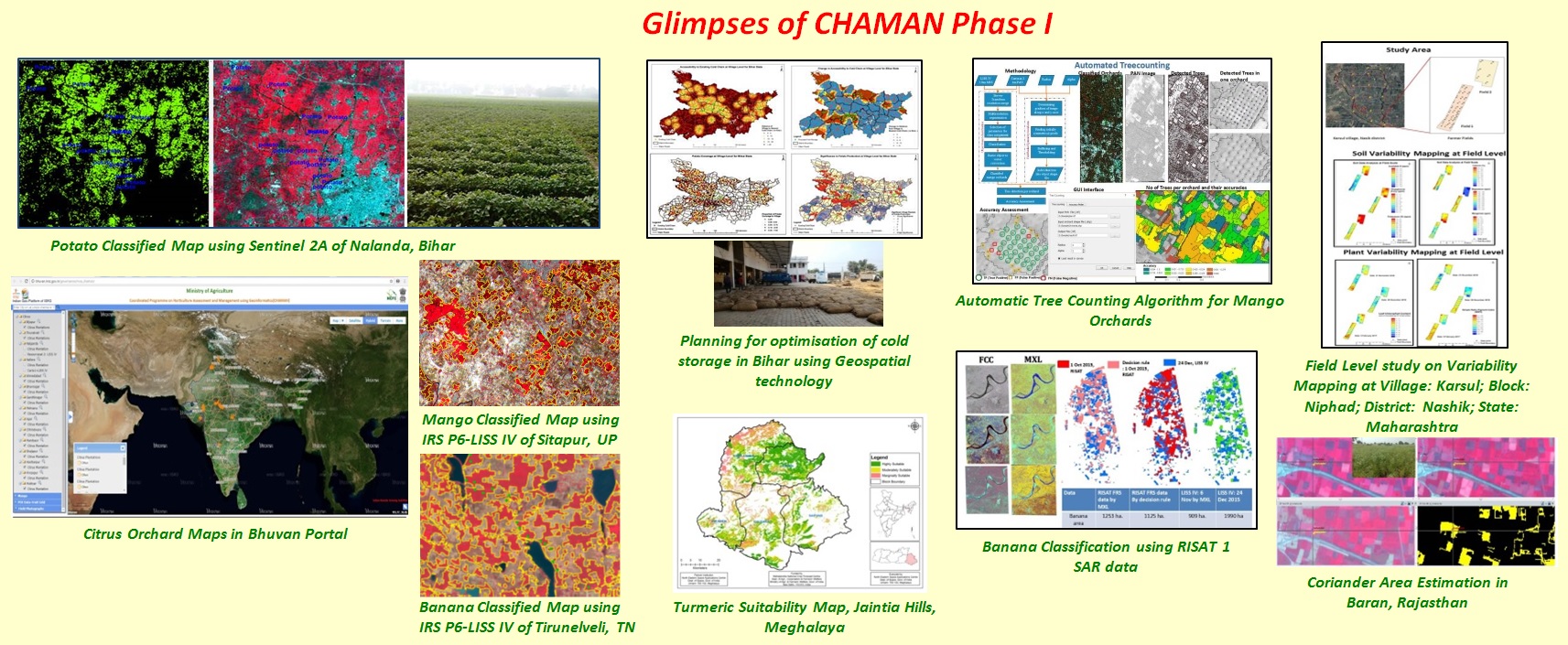
Major Achievements under CHAMAN Phase- I
- Area assessment and production forecasting of 7 major horticultural crops in selected districts of major states (12 states, 185 Districts).
- National/State/District level area and production estimation for 7 major horticultural crops i.e. Mango, Banana, Citrus, Potato, Onion, Chilli & Tomato.
- Horticulture Expansion Plan for Jhum land areas of NER States (one districts in each NER state).
- Hyperspectral Signature Library and Precision Farming.
- Development of collaboration with various state horticulture departments.
- Capacity Building.
CHAMAN Phase-II
Based on the success of the CHAMAN-Phase-I, DAC&FW has approved the Phase-II of CHAMAN project for the period 2018-19 & 2019-20. The major goals of the CHAMAN Phase-II are operationalization of the technologies developed during the Phase-I, taking up new crops and research & development studies, especially the crop yield modelling.
A. Area Assessment & Production Forecasting
Operational Mode
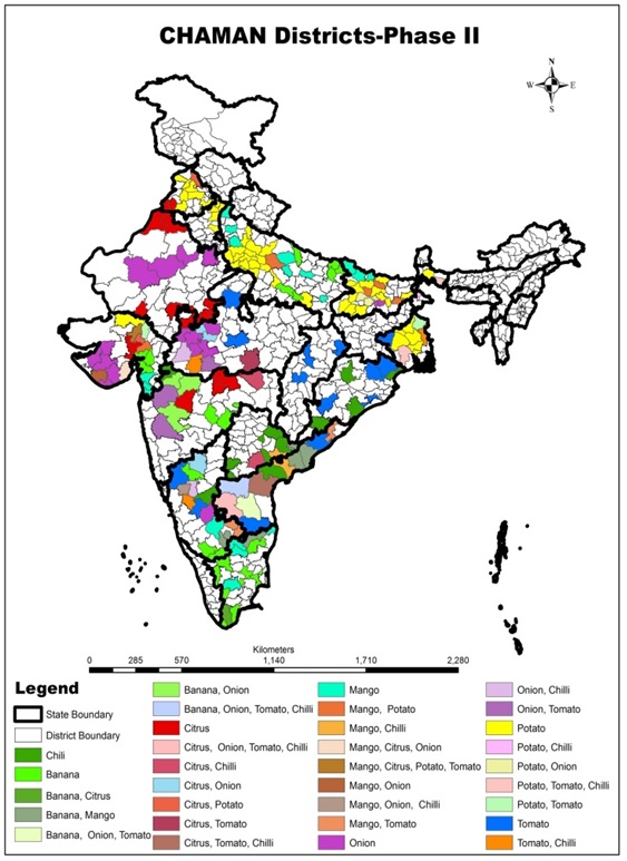
Operational implementation of area assessment and production forecasting of 7 horticultural crops in 263 districts of 15 states
Pilot Mode
Technique development for area assessment and production forecasting of:
- Spices: Coriander, Cumin
- Aromatic Plants: Mentha
- Fruits: Grapes,Pomegranate, Apple.
- Plantation crops: Coconut.
B. Geospatial applications for horticultural developments and management planning
- Horticulture development Studies (Jhum land area, 2-3 districts in each NER states)
- Horticulture expansion planning studies (2 districts each in 8-10 states)
- Horticultural crop maps (2 districts each in major horticulture states)
C. Geospatial applications for horticultural developments and management planning
- Use of SAR data for kharif vegetable crops assessment
- Improvement of Yield modelling
- UAV based signature studies
- Precision Farming Studies
Partner Organizations
- Horticulture Statistics Division, DACFW
- Mahalanobis National Crop Forecast Centre (MNCFC), DACFW
- Space Applications Centre (SAC), ISRO
- National Remote Sensing Centre (NRSC), ISRO
- North Eastern Space Applications Centre (NESAC)
- ICAR Crop Specific Centre(s) and IARI
- State Horticulture Departments
- State Remote Sensing Centres
- Institute of Economic Growth
- India Meteorological Department
Expected Deliverables
- Operational district/state/national level estimates for 7 major horticultural crop
- Horticultural expansion plans for selected districts
- Horticultural maps for selected districts
- Orchard maps on geoportal
- Methodology for new crops
- Horticultural crop signature library
- Development of Yield models
- Capacity building